


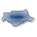
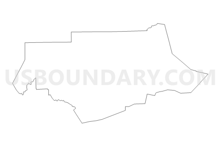
Lycoming & Clinton Counties PUMA, Pennsylvania
About
Outline

Summary
| Unique Area Identifier | 193898 |
| Name | Lycoming & Clinton Counties PUMA |
| State | Pennsylvania |
| Area (square miles) | 2,140.77 |
| Land Area (square miles) | 2,116.58 |
| Water Area (square miles) | 24.19 |
| % of Land Area | 98.87 |
| % of Water Area | 1.13 |
| Latitude of the Internal Point | 41.29808030 |
| Longtitude of the Internal Point | -77.30403050 |
Maps


Graphs
Select a template below for downloading or customizing gragh for Lycoming & Clinton Counties PUMA, Pennsylvania


Neighbors
Neighoring Public Use Microdata Area (by Name) Neighboring Public Use Microdata Area on the Map
- Bradford, Tioga & Sullivan Counties PUMA, PA
- Centre County PUMA, PA
- Clearfield, McKean, Elk, Potter & Cameron Counties PUMA, PA
- Columbia & Luzerne (West) Counties--Bloomsburg Town & Berwick Borough PUMA, PA
- Mifflin, Union, Snyder & Juniata Counties PUMA, PA
- Northumberland & Montour Counties PUMA, PA
Top 10 Neighboring County (by Population) Neighboring County on the Map
- Centre County, PA (153,990)
- Lycoming County, PA (116,111)
- Northumberland County, PA (94,528)
- Clearfield County, PA (81,642)
- Columbia County, PA (67,295)
- Bradford County, PA (62,622)
- Union County, PA (44,947)
- Tioga County, PA (41,981)
- Clinton County, PA (39,238)
- Montour County, PA (18,267)
Top 10 Neighboring County Subdivision (by Population) Neighboring County Subdivision on the Map
- Williamsport city, Lycoming County, PA (29,381)
- Loyalsock township, Lycoming County, PA (11,026)
- Lock Haven city, Clinton County, PA (9,772)
- South Williamsport borough, Lycoming County, PA (6,379)
- Gregg township, Union County, PA (4,984)
- Old Lycoming township, Lycoming County, PA (4,938)
- Montoursville borough, Lycoming County, PA (4,615)
- Delaware township, Northumberland County, PA (4,489)
- White Deer township, Union County, PA (4,437)
- Walker township, Centre County, PA (4,433)
Top 10 Neighboring Place (by Population) Neighboring Place on the Map
- Williamsport city, PA (29,381)
- Lock Haven city, PA (9,772)
- South Williamsport borough, PA (6,379)
- Montoursville borough, PA (4,615)
- Jersey Shore borough, PA (4,361)
- Kenmar CDP, PA (4,124)
- Garden View CDP, PA (2,503)
- Muncy borough, PA (2,477)
- Hughesville borough, PA (2,128)
- Mill Hall borough, PA (1,613)
Top 10 Neighboring Unified School District (by Population) Neighboring Unified School District on the Map
- Williamsport Area School District, PA (41,746)
- Keystone Central School District, PA (37,799)
- Bellefonte Area School District, PA (25,328)
- Jersey Shore Area School District, PA (17,858)
- Warrior Run School District, PA (17,290)
- Milton Area School District, PA (16,580)
- Mifflinburg Area School District, PA (16,360)
- Southern Tioga School District, PA (15,719)
- Bald Eagle Area School District, PA (13,206)
- Montoursville Area School District, PA (13,205)
Top 10 Neighboring State Legislative District Lower Chamber (by Population) Neighboring State Legislative District Lower Chamber on the Map
- State House District 171, PA (67,294)
- State House District 85, PA (66,182)
- State House District 76, PA (63,384)
- State House District 109, PA (62,749)
- State House District 108, PA (62,303)
- State House District 110, PA (59,579)
- State House District 68, PA (59,039)
- State House District 83, PA (58,867)
- State House District 74, PA (58,607)
- State House District 107, PA (58,546)
Top 10 Neighboring State Legislative District Upper Chamber (by Population) Neighboring State Legislative District Upper Chamber on the Map
- State Senate District 34, PA (268,795)
- State Senate District 27, PA (256,971)
- State Senate District 23, PA (248,605)
- State Senate District 25, PA (233,497)
- State Senate District 35, PA (232,251)
Top 10 Neighboring 111th Congressional District (by Population) Neighboring 111th Congressional District on the Map
- Congressional District 11, PA (687,860)
- Congressional District 10, PA (669,257)
- Congressional District 5, PA (651,762)
Top 10 Neighboring Census Tract (by Population) Neighboring Census Tract on the Map
- Census Tract 307, Clinton County, PA (7,780)
- Census Tract 117, Lycoming County, PA (7,427)
- Census Tract 802, Northumberland County, PA (7,119)
- Census Tract 108, Lycoming County, PA (7,040)
- Census Tract 902, Union County, PA (6,452)
- Census Tract 116.02, Lycoming County, PA (6,379)
- Census Tract 107, Lycoming County, PA (6,094)
- Census Tract 119, Lycoming County, PA (5,962)
- Census Tract 3, Lycoming County, PA (5,959)
- Census Tract 105, Lycoming County, PA (5,798)
Top 10 Neighboring 5-Digit ZIP Code Tabulation Area (by Population) Neighboring 5-Digit ZIP Code Tabulation Area on the Map
- 17701, PA (44,661)
- 17745, PA (19,063)
- 17740, PA (12,754)
- 17756, PA (12,408)
- 17754, PA (12,233)
- 17702, PA (10,721)
- 17844, PA (10,042)
- 17751, PA (7,084)
- 17777, PA (7,056)
- 17737, PA (6,220)